![Geography](https://static.wixstatic.com/media/11062b_e2a46d33ba314c6ca1be92747524fe9c~mv2.jpg/v1/fill/w_753,h_502,al_c,q_85,usm_0.66_1.00_0.01,enc_avif,quality_auto/11062b_e2a46d33ba314c6ca1be92747524fe9c~mv2.jpg)
![Final 1.png](https://static.wixstatic.com/media/aff319_ae2ef5192e664077a1776d4ea2e4d6d2~mv2.png/v1/fill/w_83,h_95,al_c,q_85,usm_0.66_1.00_0.01,enc_avif,quality_auto/Final%201.png)
Our Services
Exclusive Services
![](https://static.wixstatic.com/media/aff319_def635d4cd0b4e50bfaaa5f0c7b43d3d~mv2.png/v1/fill/w_600,h_260,al_c,q_85,usm_0.66_1.00_0.01,enc_avif,quality_auto/aff319_def635d4cd0b4e50bfaaa5f0c7b43d3d~mv2.png)
We provide clients with service that adhere to rigorous standards of high quality.
We address challenges with exceptional intelligence and deliver optimal expertise to provide solutions.
Geospatial Services
![OIP_edited_edited.png](https://static.wixstatic.com/media/aff319_9727696c4da2496c911ba47f03ff3247~mv2.png/v1/fill/w_204,h_137,al_c,lg_1,q_85,enc_avif,quality_auto/OIP_edited_edited.png)
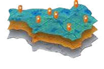
Building footprint capturing
Digitization of maps and
satellite imagery
2D & 3D data capturing and validation
Utility mapping
Geotagging and Geostatistical mapping
![](https://static.wixstatic.com/media/aff319_a5e8033c39d64340890ebeb1e32ca5fe~mv2.jpg/v1/fill/w_437,h_275,al_c,q_80,usm_0.66_1.00_0.01,enc_avif,quality_auto/aff319_a5e8033c39d64340890ebeb1e32ca5fe~mv2.jpg)
![Screenshot 2023-08-29 164257_edited.jpg](https://static.wixstatic.com/media/aff319_0972f65402324e52848510e0dbc0a7c7~mv2.jpg/v1/fill/w_435,h_328,al_c,q_80,usm_0.66_1.00_0.01,enc_avif,quality_auto/Screenshot%202023-08-29%20164257_edited.jpg)
![Capture3 copy 2.png](https://static.wixstatic.com/media/aff319_dc91b832b2854807958c0a301f4bfe8f~mv2.png/v1/fill/w_439,h_219,al_c,q_85,usm_0.66_1.00_0.01,enc_avif,quality_auto/Capture3%20copy%202.png)
![imgbin_architectural-engineering-skyline-building-silhouette-png_edited.png](https://static.wixstatic.com/media/aff319_387757d77a8e444784adadf3abb7ce71~mv2.png/v1/crop/x_205,y_0,w_795,h_111/fill/w_442,h_62,al_c,q_85,usm_0.66_1.00_0.01,enc_avif,quality_auto/imgbin_architectural-engineering-skyline-building-silhouette-png_edited.png)
![](https://static.wixstatic.com/media/aff319_52d5fc961e834f46a40ba7c3dbf1026e~mv2.png/v1/fill/w_424,h_268,al_c,q_85,usm_0.66_1.00_0.01,enc_avif,quality_auto/aff319_52d5fc961e834f46a40ba7c3dbf1026e~mv2.png)
![Capture77.JPG](https://static.wixstatic.com/media/aff319_fe608c09d07c4b1aafef7425cbb27477~mv2.jpg/v1/fill/w_426,h_422,al_c,q_80,usm_0.66_1.00_0.01,enc_avif,quality_auto/Capture77_JPG.jpg)
![Screenshot 2023-09-01 150655.png](https://static.wixstatic.com/media/aff319_bce8ce6af7c14d1bbc851329b70eb865~mv2.png/v1/fill/w_424,h_242,al_c,q_85,usm_0.66_1.00_0.01,enc_avif,quality_auto/Screenshot%202023-09-01%20150655.png)
![Raster_edited.png](https://static.wixstatic.com/media/aff319_55f838b4c9ce4290867190b804d65f6c~mv2.png/v1/fill/w_180,h_229,al_c,q_85,usm_0.66_1.00_0.01,enc_avif,quality_auto/Raster_edited.png)
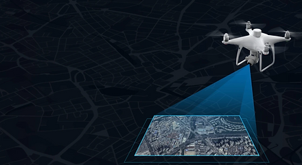
Remote Sensing Services
![Photogrammetry_edited.png](https://static.wixstatic.com/media/aff319_2400d70aa0574fc6960d03c25686816a~mv2.png/v1/fill/w_251,h_141,al_c,q_85,usm_0.66_1.00_0.01,enc_avif,quality_auto/Photogrammetry_edited.png)
Land Use and Land Cover mapping
Data processing, interpretation and analysis
Satellite data interpretation, analysis and change detection
Geocoding and Image/Video annotation for Artificial Intelligence
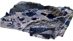
Photogrammetry Services
![Capture11_edited.png](https://static.wixstatic.com/media/aff319_eba6cb43ea6d48a49bb9c36ca5336094~mv2.png/v1/fill/w_375,h_158,al_c,q_85,usm_0.66_1.00_0.01,enc_avif,quality_auto/Capture11_edited.png)
DEM, DSM,DTM creation and analysis
Linear reference system and
data acquisition
3D data capturing and analysis
TIN Data analysis and creation
Preparation of soil maps, forest maps, geologic maps, maps for city and regional planning and zoning
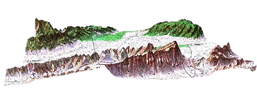
![Screenshot 2023-09-01 164724.png](https://static.wixstatic.com/media/aff319_ee32666bd6a74b938069c3409fef6099~mv2.png/v1/fill/w_440,h_340,al_c,q_85,usm_0.66_1.00_0.01,enc_avif,quality_auto/Screenshot%202023-09-01%20164724.png)
![](https://static.wixstatic.com/media/aff319_d750cb7b1da9402089c09a05f8fb8d76~mv2.png/v1/fill/w_440,h_248,al_c,q_85,usm_0.66_1.00_0.01,enc_avif,quality_auto/aff319_d750cb7b1da9402089c09a05f8fb8d76~mv2.png)
![](https://static.wixstatic.com/media/aff319_78fc5f73887f4651bfe7a9d9a213ad1c~mv2.png/v1/fill/w_440,h_240,al_c,q_85,usm_0.66_1.00_0.01,enc_avif,quality_auto/aff319_78fc5f73887f4651bfe7a9d9a213ad1c~mv2.png)
![Capture6-removebg-preview copy.png](https://static.wixstatic.com/media/aff319_4e23bc8d6f664af8ab94cea703c0a60e~mv2.png/v1/fill/w_291,h_152,al_c,q_85,usm_0.66_1.00_0.01,enc_avif,quality_auto/Capture6-removebg-preview%20copy.png)
![Screenshot 2023-09-01 171027.png](https://static.wixstatic.com/media/aff319_d1976876ad67417896c9f46e00434ef6~mv2.png/v1/fill/w_442,h_224,al_c,q_85,usm_0.66_1.00_0.01,enc_avif,quality_auto/Screenshot%202023-09-01%20171027.png)
![Screenshot 2023-09-01 171227.png](https://static.wixstatic.com/media/aff319_9b868e22139a4da39ff94479e3d96b2f~mv2.png/v1/fill/w_442,h_176,al_c,q_85,usm_0.66_1.00_0.01,enc_avif,quality_auto/Screenshot%202023-09-01%20171227.png)
![Screenshot 2023-09-01 171404_edited.png](https://static.wixstatic.com/media/aff319_2626613bfc264af7b208bd382dc2f48c~mv2.png/v1/fill/w_200,h_198,al_c,q_85,usm_0.66_1.00_0.01,enc_avif,quality_auto/Screenshot%202023-09-01%20171404_edited.png)
LiDAR
Data classification and feature extraction
Mapping and modelling of LiDAR data
![Screenshot 2023-09-01 171511_edited.png](https://static.wixstatic.com/media/aff319_89cde3d8c0c64a7ca3886e7b1e31129b~mv2.png/v1/fill/w_233,h_168,al_c,q_85,usm_0.66_1.00_0.01,enc_avif,quality_auto/Screenshot%202023-09-01%20171511_edited.png)
![Screenshot 2023-09-01 171511.png](https://static.wixstatic.com/media/aff319_3dd94609c930439ca5fa5b1732d44ec0~mv2.png/v1/fill/w_221,h_159,al_c,q_85,usm_0.66_1.00_0.01,enc_avif,quality_auto/Screenshot%202023-09-01%20171511.png)